We continue to have a great field season. Today we excavated another area of the Ceren sacbe (road). Our excavations have maize fields on each side of the sacbe. Our plaster plant casts of the maize (corn) show multiple ears of corn and in one case we are even able to see the corn kernals.
Check out the photo published a few weeks back of our of our plant casts:
http://news.yahoo.com/photos/christine-dixon-student-university-colorado-shows-ear-corn-photo-230357713.html
We also documented an ancient manioc field that was so worn down and compacted, we were able to interpret this as a manioc field that was no longer in use at the Ceren site at the time of the eruption. The fields appear to have been not used for a season or longer (given the erosion and compacted areas).
I will post more when our Internet connection is a bit stronger (rainy season makes for more difficult Internet connections) and plan some upcoming posts on paleoethnobotony, lab work, and a list of fields dos and don'ts to remember! Stay tuned. For now I'm going to go see what the latest flying bug is that has caused half of my field crew to run around screaming.
Wednesday, July 27, 2011
Monday, July 18, 2011
Document, Document, Document
Sometimes people imagine that all archaeologists do is dig, fight off snakes, and chase down looters. While those might be aspects of our archaeological work, the most important part of our work in the field is documentation. Without documentation the artifacts, ecofacts, and other data we encounter are rendered almost useless. The context and provenience of what we excavate allow us to reconstruct the stories of the past.
![]()
![]()
![]()
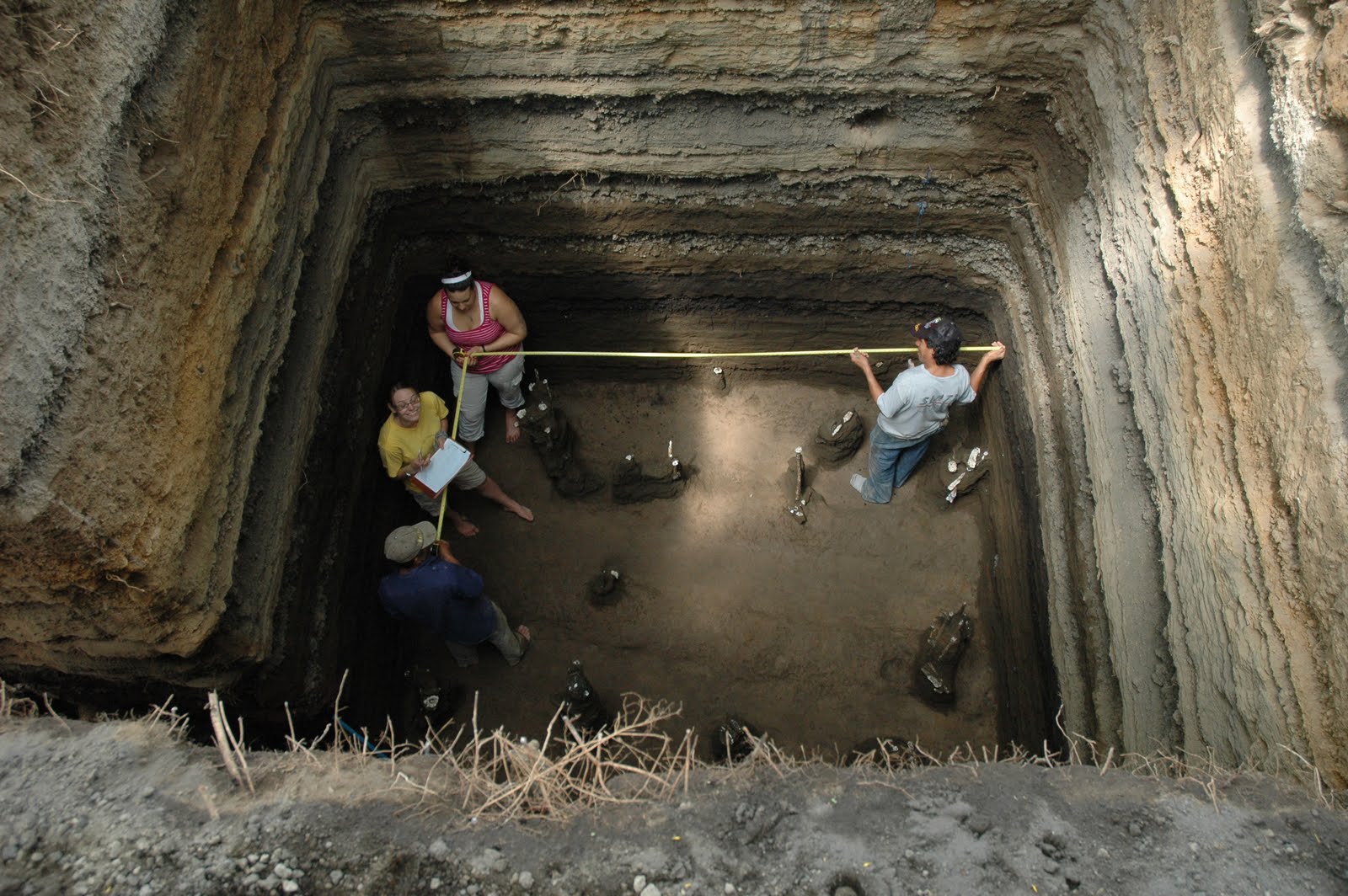
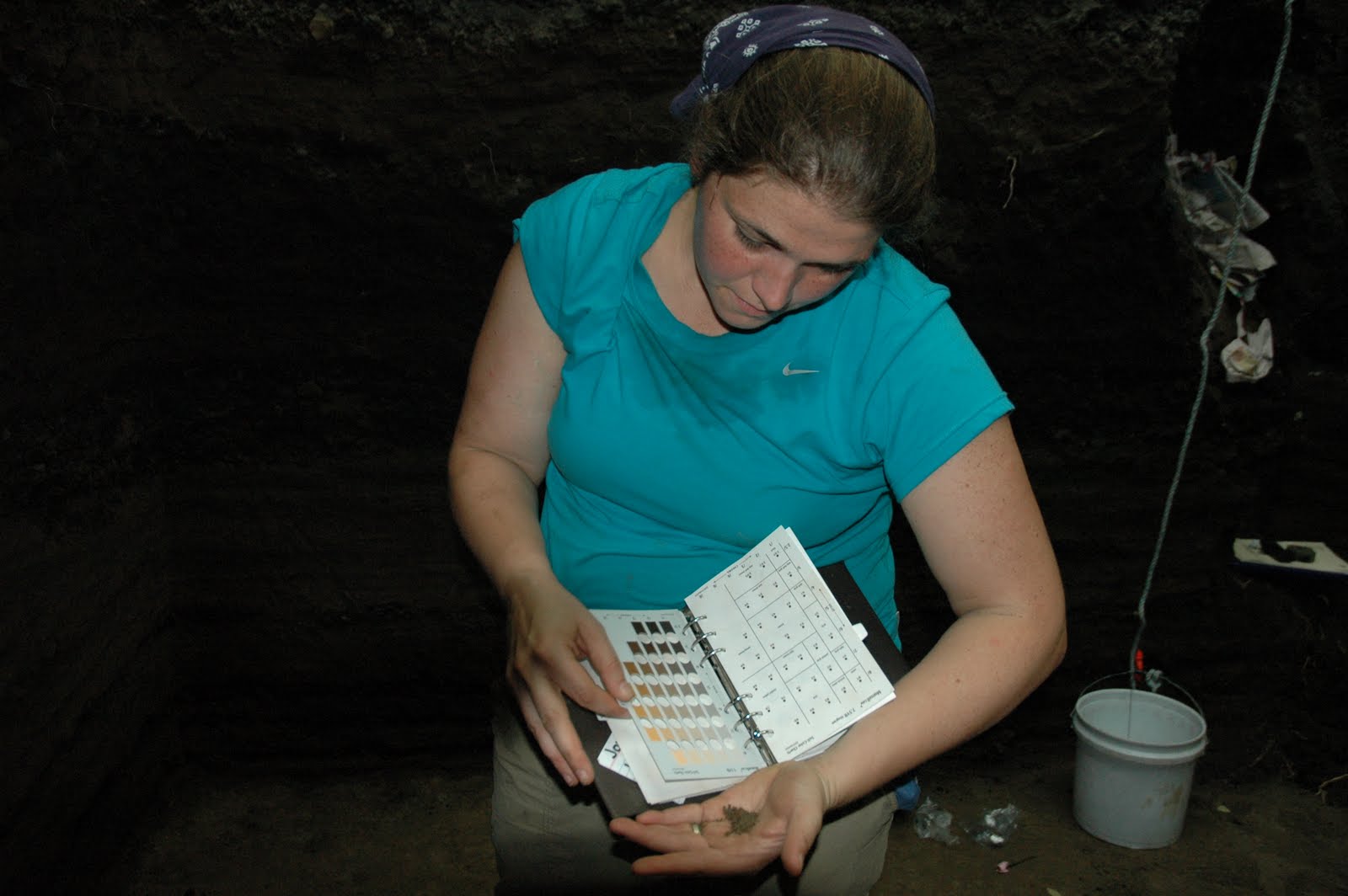
So what to document in our excavations? Typically we document by drawing maps of the excavation in plan view (bird's eye view) and profile view (cross-section). We record information about the ridges and furrows (height, spacing, direction), we record how deep we are below the ground surface, and even differences in color along the ground surface. Since colors are often subjective, cultural influenced, and names not agreed upon, we utilize a system of standardization by using a Munsell Soil Chart. This book contains a variety of colors (each given names - e.g. 10 YR 3/5) that we compare our soils to for a color description. We wet the soil or sediment (note that dirt is not a scientific term and soil and sediments are not the same) and then compare these to the color swatches in the book. It can be frustrating to decide which color you have, but this system provides a way to standardize our observations of color.

The moral of this archaeological tale... DOCUMENT, DOCUMENT, DOCUMENT. Our job is to record as much data as possible when we excavate. The archaeolgoical record is a non-renewable resources, so once we have dug it up we cannot go back and re-excavate. We get one shot to do this right and that responsiblity weighs heavy at Ceren, where we have a very special data set to record each day.
Catching up!
Sorry for the delay in posts but we have been sick around here the past week! Head colds in the tropics are not so fun but our field crew is on the mend and we are continuing to enjoy our Ceren work.
Having had so many of us fighting through ear infections, fevers, coughs, and what not has given us a lot to catch up on. So here we go, we have opened many more excavations (we are beginning our 12th operation of the field season tomorrow - all 3m x 3m in size).
Our road I first posted about to you has been declared an official Sacbe by Maya experts due to its shape, size, and the level of investment put into not only building the road but also the canals on the sides. We have now documented the first earthen ancient Maya sacbe in two test pits. In the second test pit that exposed a section of the sacbe we had very well constructed canals on either side and again a width of approximtely 2 meters. There appear to be maize fields of either side of our sacbe and we suspect that the sacbe runs into an area where a ritual feast was underway when the volcano erupted. This has been hugely exciting! We are now excavating an area even closer to the site where we think the sacbe runs and will likely expose this during this week. If the sacbe does extend to this area we will have confirmed approximately 40 meters in length of this road!
 |
| From Left to Right Maize Plant, Constructed Canal, and Ceren Sacbe |
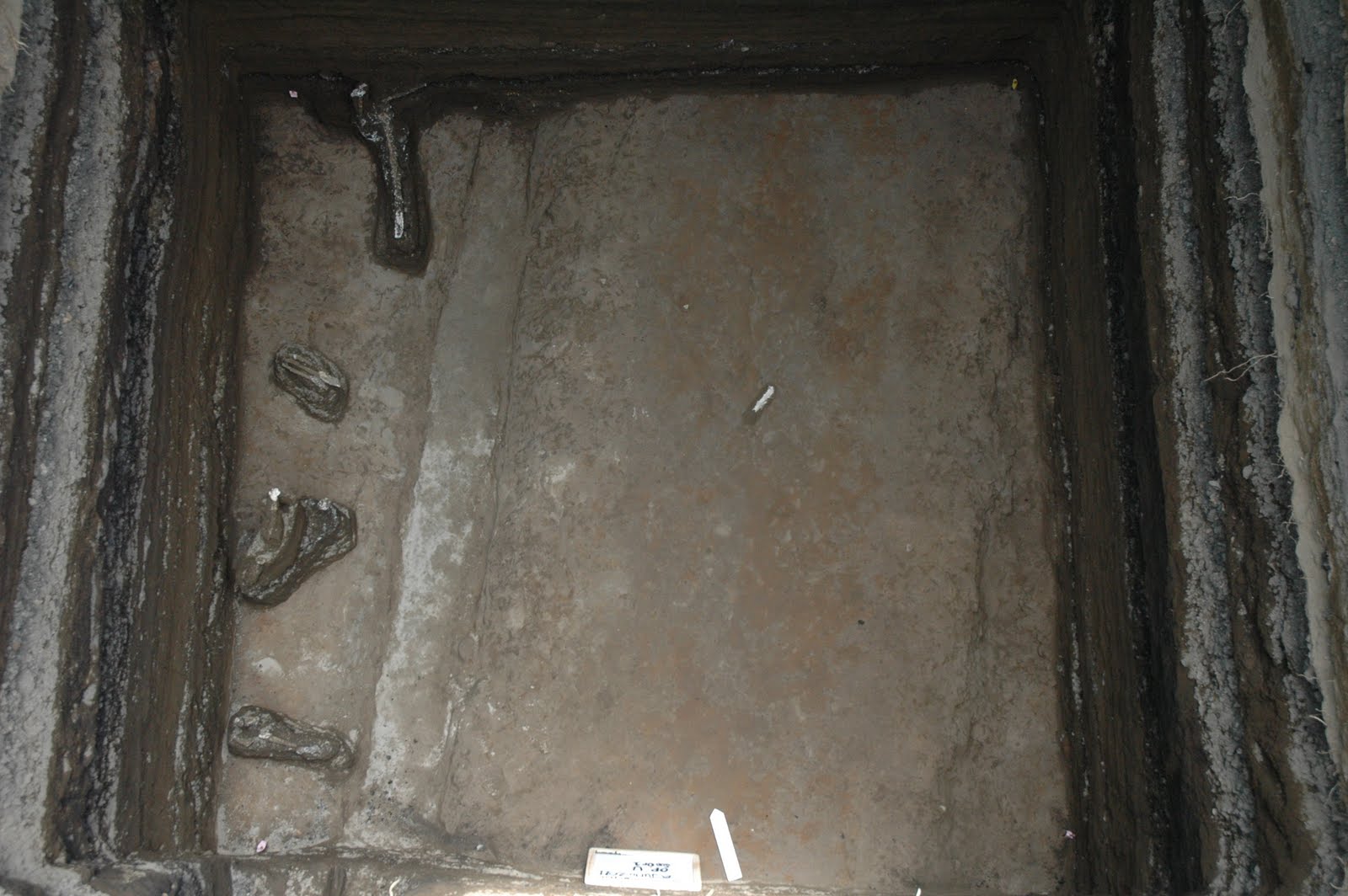 |
| Plan View of Ceren Sacbe |
Subscribe to:
Posts (Atom)